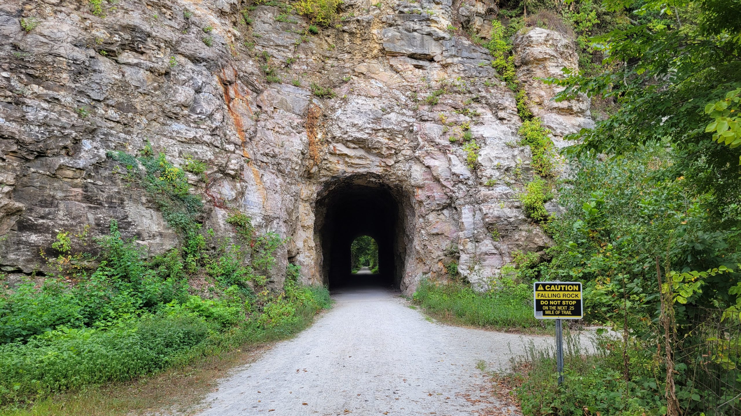
Rocheport sits right on the Katy Trail, Missouri’s 240-mile rail-trail across the middle of the state, and it makes one of the easiest places to start a ride. The trailhead is in the town, the trail is flat, and the one tunnel on the whole trail is a short pedal away. Here’s what you actually need to know before you go.
The trailhead
The Rocheport trailhead is at the foot of First Street, at the east edge of the town, at about mile marker 178.3 on the trail (Missouri State Parks). Parking is free, and there’s a restroom with water and a kiosk with a trail map. From the lot it’s a short ride west to the tunnel, and the town’s shops and restaurants are a couple of blocks back the other way.
The tunnel
Head west from the trailhead and in less than half a mile you reach the tunnel, near mile marker 178.7. It’s the only tunnel on the entire Katy Trail: 243 feet of passage blasted through the limestone bluff by crews building the Missouri-Kansas-Texas Railroad, the line everyone called the MKT, or “Katy.” They cut through the rock in 1892 and finished the tunnel in 1893, and you can still see tool marks in the walls. Inside it stays cool year-round, around 55 degrees, a real relief on a hot afternoon. It’s dark enough that a headlight or phone light helps, and the far end opens onto the river valley. Most people slow down here whether they meant to or not.
The surface and the terrain
The Katy is crushed limestone the whole way, not pavement. It’s firm and fast when dry and soft for a day or two after heavy rain. Road bikes can handle it, but wider tires, 32mm and up, ride more comfortably. Through Rocheport the trail is flat to gently rolling, running along the base of the river bluffs to the west and out across the bottomland to the east. This stretch follows the Missouri River corridor, so you won’t climb much.
How far to the next town
From Rocheport it’s about 9 miles east to the McBaine trailhead (mile marker 169.5), where a spur connects toward the Columbia trail system. A ride out to the McBaine cottonwood and back makes a good half-day. Head west and it’s roughly 13.5 miles to Boonville; stronger riders go that way and arrange a shuttle back rather than doubling the distance. West of Rocheport the mile markers climb toward Boonville; east of town they drop toward McBaine and Hartsburg.
Renting a bike and stocking up
Don’t have a bike? Meriwether Cafe & Bike Shop, at 700 First Street right by the trailhead, rents bikes and serves coffee and scratch-made food. Call ahead to check rental availability, especially on weekends, and stop in for water or a snack before you roll out even if you brought your own wheels.
Best seasons
Late April through May and September through October are the good stretches: mild temperatures, good light, and the trees doing their thing in spring and fall. Summer works, but July and August get hot and humid, so start early. Winter riding is fine on dry days; the trail isn’t cleared for snow.
What to know before you ride
Water is available at the trailhead. The nearest bike shop for repairs is in Columbia, so carry a tube, a patch kit, and a pump; you’re on your own out on the trail. Cell coverage gets spotty west of town, so tell someone your route and when you expect to be back. Pack more water than you think you’ll need, plus a snack, sunscreen, and a light layer for the tunnel.
The trail is busiest on weekends from May through October, with families and walkers near the trailhead; midweek mornings are the quietest. On etiquette: stay to the right, call out when you pass (“on your left”), and yield to horses, which have the right of way on shared-use trails. Pack out what you pack in.
After your ride
Meriwether Cafe is the easy call: food, cold drinks, right at the trailhead. Les Bourgeois Vineyards’ A-Frame on the bluff above town is a short drive or a steep spur ride up, and the Missouri River view from the top is worth the climb. The Rocheport General Store is a good last stop for coffee and local goods before the drive home.